Outdoor Activities
Hiking Grandfather Mountain State Park: Which Grandfather Mountain You Actually Mean
Two separate places share the name. One is a state park with free, rugged backcountry trails; the other is a privately operated attraction that charges admission. Knowing which one you are driving to is the first decision, and checking conditions on the day is the second.
A good share of the questions about Grandfather Mountain are really one question wearing a disguise: which Grandfather Mountain?
Two separate places share the name. They sit next to each other. Their trails connect. They are run by different organizations, and only one of them charges you to come in.
Our family activities guide flags this already, because getting it wrong costs money. This article goes further, because getting it wrong also means arriving expecting a nature center and finding a mountainside that wants ladders.
This is researched rather than lived: the owners have not hiked here.
The two Grandfather Mountains
Grandfather Mountain State Park is a North Carolina state park. It covers roughly 2,600 acres, with something in the region of twelve miles of rugged backcountry trail. Access is free. Backcountry campsites are available by permit.
Grandfather Mountain, without “State Park”, is a privately operated attraction that charges admission, run by the Grandfather Mountain Stewardship Foundation. It is home to the Mile High Swinging Bridge, a nature center, and the wildlife habitats.
They are adjacent, their trails connect, and they are independently operated. That last point has a practical consequence worth knowing before you start making phone calls: North Carolina State Parks directs questions about the attraction to the Foundation. Each is the authority for its own ground, and neither speaks for the other.
If your group wants the bridge, the animals and an indoor exhibit hall, you want the attraction. If your group wants a hard hike with no ticket, you want the state park. Those are genuinely different days out, and families regularly turn up expecting one having researched the other.
What the hiking is actually like
Plainly: this is not casual family walking.
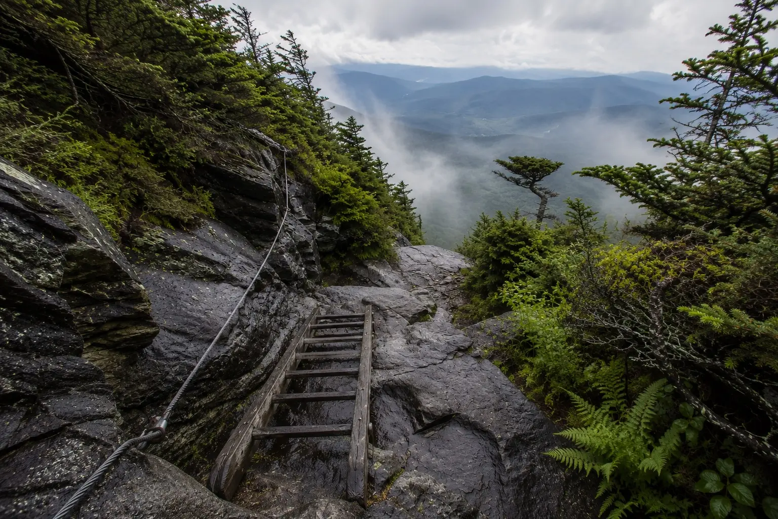
The trails are steep, and some routes use ladders and cables. That is not a colorful way of saying strenuous. It means stretches where you are using your hands on fixed climbing aids rather than walking a path, while carrying whatever you brought.
This is real backcountry hiking, and it is the right day out for the people it suits. It is a poor choice for anyone looking for an easy afternoon, and a worse one for anyone who has been talked into it.
Temperatures on the mountain run several degrees colder than in Banner Elk. Pack for the mountain rather than for the valley you set out from, whatever the season.
If someone in the group wants a shorter day on their feet, the family activities guide has the lower-effort options, and the attraction side of Grandfather Mountain is among them.
Three managers, one mountain
Before you go looking for current information about any of this, there is a complication worth understanding, because it decides which page you should be reading.
The state park’s trails also connect to the Asutsi Trail and the Tanawha Trail, both of which are managed by the National Park Service as part of the Blue Ridge Parkway.
So a single walk on this mountain can cross ground held by a state park, a private foundation and a federal agency. We name those two trails here only to explain who manages what. We are not telling you they are open, and we are not suggesting a route. See the section below for why.
The useful takeaway is that different parts of this mountain answer to different authorities. Whoever manages the ground you plan to be standing on is the one to ask about it.
Why we name no trail, no trailhead and no parking area
This is the part of the article that matters most, so it gets said directly.
Trails and parking areas here have been affected by Hurricane Helene damage, and closures are still in effect. When this was researched, sources did not agree with each other about what was currently open.
We could have picked one and published it. A list of recommended trails and a note about where to park would make this a more satisfying page to read, and it would look authoritative for exactly as long as it took to be wrong.
The failure mode is specific and worth naming: a family drives out on the strength of a page like this one, finds a closed trailhead or a closed parking area, and now has a ruined morning and a decision to remake from the roadside. A closure does not announce itself in advance to a page written months earlier.
So we publish no route, no trailhead, no parking guidance and no recommended trail. Not because the information does not exist, but because the only version of it worth having is the version from this morning.
What to do instead
Check the park’s own page at North Carolina State Parks before you set out, on the day you are going. Not the week before. Conditions and closures here are live information.
ncparks.gov is the authority for the state park side: access, closures, trail status and camping permits. For anything about the paid attraction, the Grandfather Mountain Stewardship Foundation is the authority, and the state park will tell you the same.
Two other things worth doing the night before. Make sure everyone in the group knows which of the two Grandfather Mountains you are actually going to. And tell someone outside the group what you decided, because backcountry hiking here is not the kind of walk to improvise on arrival.